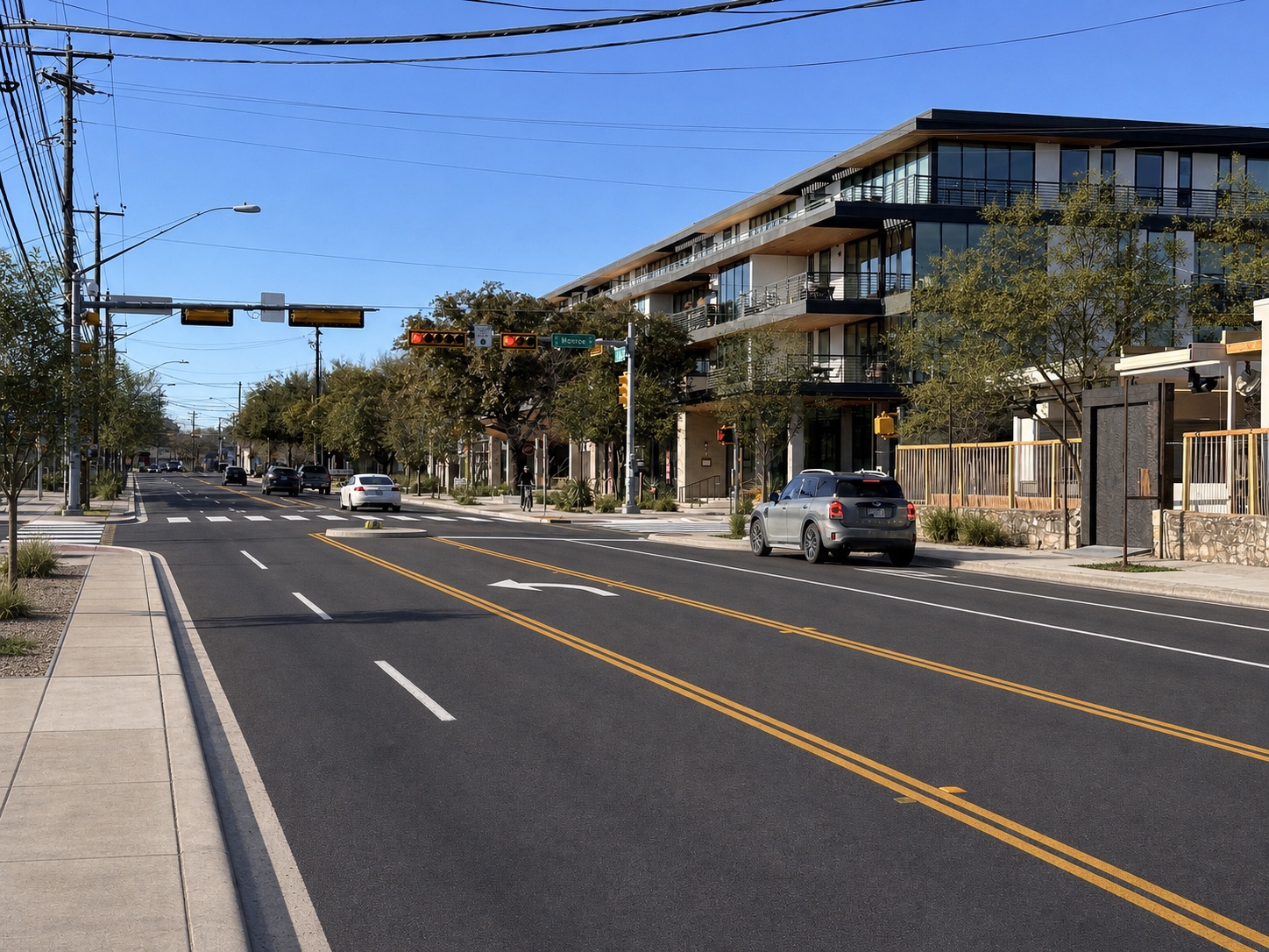
Actual street · February 2024
Four lanes for through traffic
Left turns, through traffic, buses, and business access all compete in the same lanes.
- No dedicated turning space
- Long crossing distance
- Little room for refuge or shade
A community vision for South First Street
South First Alliance began with neighbors, business owners, and people who use the street. The question is simple: could South First work better with one lane in each direction, a center space for left turns, safer crossings, clear sidewalks, and better bus stops?
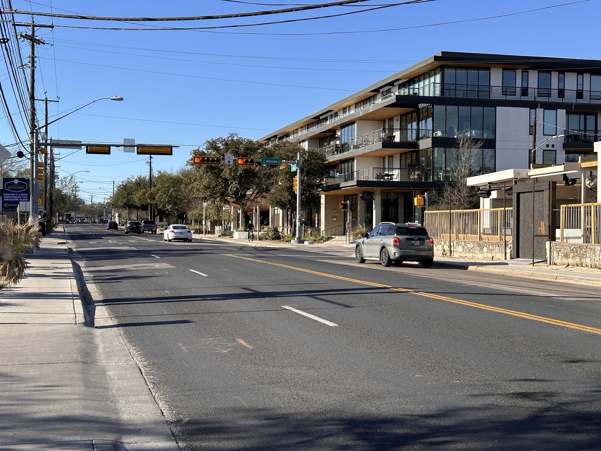
The problem, in one frame
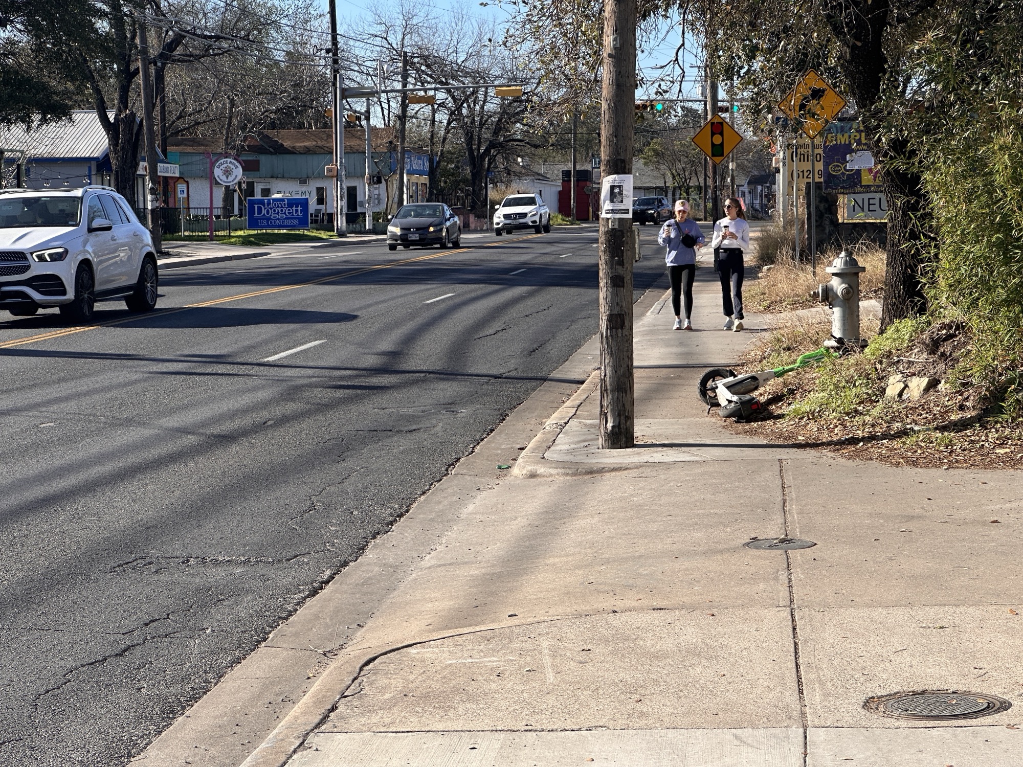
Four lanes for cars going straight leave no separate place for left turns. Along the edge, people walk through a narrow space crowded by poles, signs, and driveways.
One waiting driver can stop everyone behind them.
Poles, signs, driveways, and broken edges reduce the usable width.
There is no midpoint where a person can pause safely.
These photos were taken in 2024. Some conditions may have changed. Before a public campaign begins, the same locations should be photographed again.
Three possibilities at the same intersection
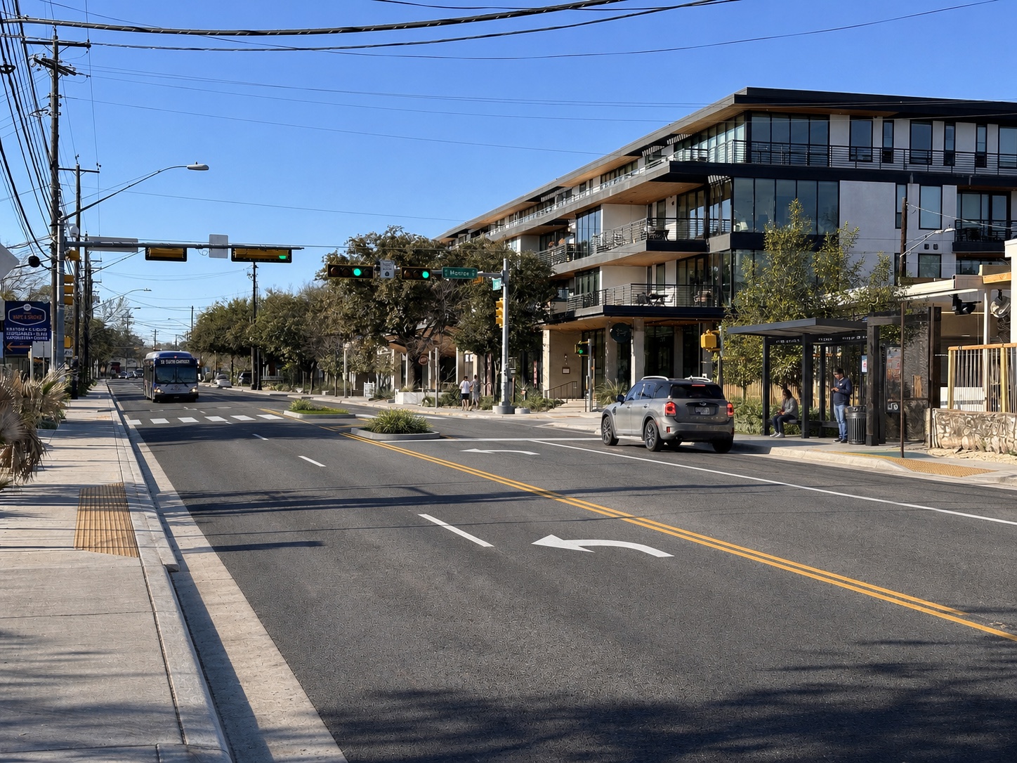
Each image starts from the real Monroe Street photograph. The buildings, signals, utilities, and camera angle stay fixed. Only the street treatment changes.
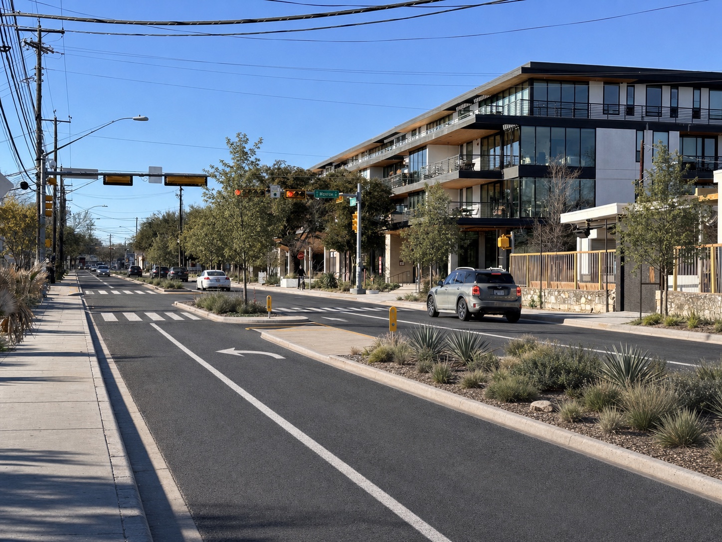
Option 02
Raised planted islands give people a safe place to stop halfway across. Short turning areas remain where homes and businesses need them.
These pictures were created with AI from the real February 2024 photograph. They show ideas only. They are not measured plans and do not tell us how traffic, drainage, utilities, or property access would work.
What the vision is trying to change
A street design is useful only if daily tasks become safer and easier.
Reach a home, business, or side street without stopping a through lane.
Use a safe place to pause halfway instead of clearing every lane at once.
Pass poles, signs, trees, and other people without stepping toward traffic.
Board from a level, accessible pad with a clear path to the sidewalk.
Plan turns, deliveries, parking, and driveway access block by block.
From what we see to what we can measure
The record shows repeated injury crashes, a strong turning pattern, and sidewalks the City marks as deficient. It supports a closer study, not a predetermined design.
Barton Springs Road to Oltorf Street
Five years of City records show repeated injury crashes near the corridor. Turning, walking conditions, transit, and missing traffic studies point to the questions the City should answer next.
See the evidence → 02A nearby Austin test
Austin measured speeding, travel time, and crashes before and after it changed Barton Springs Road.
See the comparison → 03National street-design guidance
A raised island in the middle lets someone cross one direction of traffic at a time.
See how crossing islands work ↗No current public study shows 2026 traffic volume, operating speeds, travel times, diversion, bus delay, right-of-way fit, or which lane layout would work. Those measurements should come before a design.
From pictures to a real decision
The pictures start the conversation. The next step is to bring the group back together, collect current information, listen to people who use each part of the street, and decide which ideas deserve real engineering work.
See the 30-day plan →